
Introducing HLAmap
HLAmap is a unique, Scotland-wide view of land use in modern and past times. It gives an insight into the history and development of Scotland’s landscapes, providing the user with a tool to decipher elements of the historic environment.
To begin, type a placename into the 'Search' box at the top right of the Home page. Or click on the map of Scotland and then 'Pan and Zoom' to a specific area of the country.
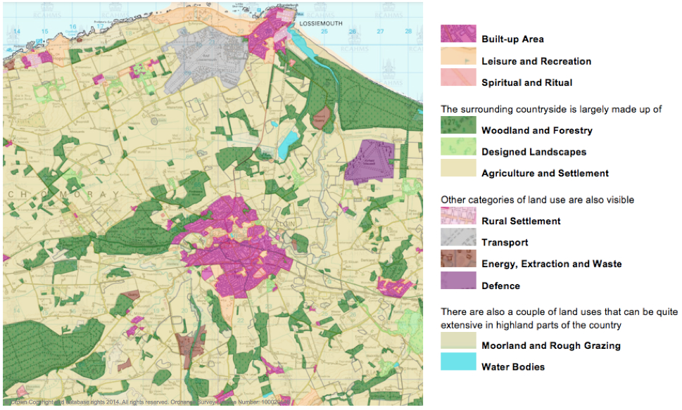
At 1:27,000 HLAmap data appears and should look like the map below. Here, an extract of part of Moray shows modern land use types grouped together into the twelve HLAmap categories that are identified in the key.
Exploring HLAmap
Within each of these categories there are numerous types, representing the various ways that Scotland’s landscapes have been used. There are over 80 of them, reflecting the complexity of the time-depth of the historic environment. Move the mouse across the map and different land use types are displayed.
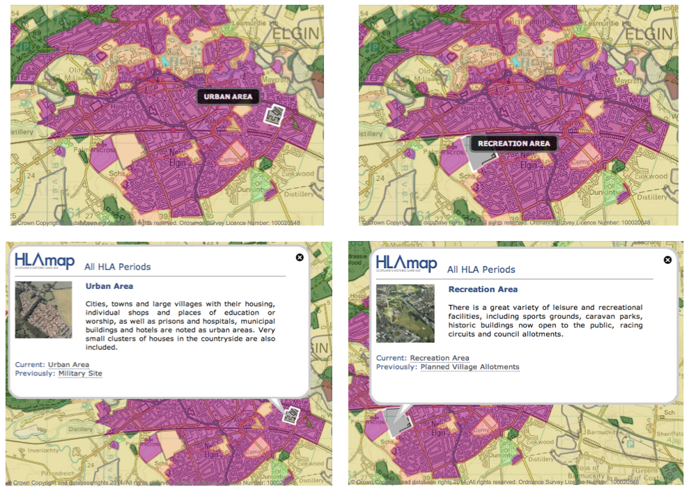
Clicking on a highlighted area brings up an info box, which also shows whether previous land uses remain. HLAmap reveals where this time-depth has survived, either above ground or below the surface and recorded through archaeological work.
A fuller description of each of these land uses can be viewed by clicking on the link in the info box. Information on all of the types can be viewed in 'HLAmap Types' on this website, or downloaded as a document for ease of reference.
Interrogating HLAmap
HLAmap is quite sophisticated. It offers various views of HLA data. The default at the top right of the map is Single Map View and 'All HLA Periods' but click on the drop-down menu and a variety of options are revealed.
Choose to view 'Modern' and you will see little difference between it and 'All HLA Periods'. But choose 'Past' and the change is dramatic. Indeed, it is so different that altering the transparency of the map at the bottom right of the screen, to around 50%, may aid visibility of the areas where such land use survives today.
Whatever view is chosen, whether it be 'Past' or a specific period like 'Prehistoric', the land use is always correctly identified when the mouse is moved over the the map. However, the colours displayed relate to the modern land use category. Gaps in the map show areas where there is no evidence for any land uses of the chosen period.
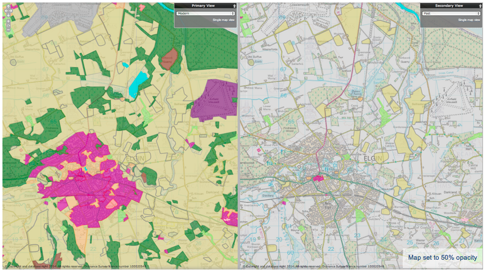
The simplest views in HLAmap are probably 'Modern' (bringing together the land use types that have been introduced since the 17th century) and 'Past' (those that are medieval and earlier in date). Click on 'Dual Map View' and you can choose to compare the two, with Modern in the Primary View and Past in the Secondary View or vice versa. HLAmap is so versatile that comparison can be made between any two chosen views from 'By Period of Origin' or 'By Land Use'.
There is also an option to view 'By Use'. This choice optimises the HLA data for a specific purpose, such as informing the initial stages of enquiry regarding land use change, perhaps for a forestry plan. Further guidance on these uses can be viewed in 'Case Studies' on this website, or downloaded as a pdf.
In addition, as long as the map is at 1:27,000 or less, you can introduce layers from Historic Environment Scotland (Listed Buildings and Scheduled Monuments) and site records from Canmore by activating the 'Additional Layers Menu'. This is very useful, as small historic or archaeological sites are not included in HLAmap as they are too little to show at a scale of 1:25,000. Areas less than one hectare in extent (100m by 100m) are not only impractical to map, they don't affect the over-arching land use of an area.
The data in the overlays can be interrogated to reveal the type and period of a site as well as any associated information that is recorded in the national database Canmore or held by Historic Environment Scotland.Additional site data is held by local authorities in their Historic Environment Records and they need to be consulted for further information. Aspects of their records can be viewed using PastMap [ pastmap.org.uk ].

