
During the 18th and 19th centuries landowners cleared clachans or fermtouns in the highlands and islands to enable agricultural improvements or sheep farming. Over time land was re-allocated, creating crofts in strips of regular size on which small crofting tenants could build a dwelling. The land was never expected to provide a living; crofting was supposed to be a part-time occupation, supplemented by fishing or other labouring work.
Typically sited at or near the coast, traditional crofting townships usually have dwellings arranged in a linear fashion along a road. More recently the older individual dwellings have been abandoned and new housing erected, but the crofts usually continue to be maintained.
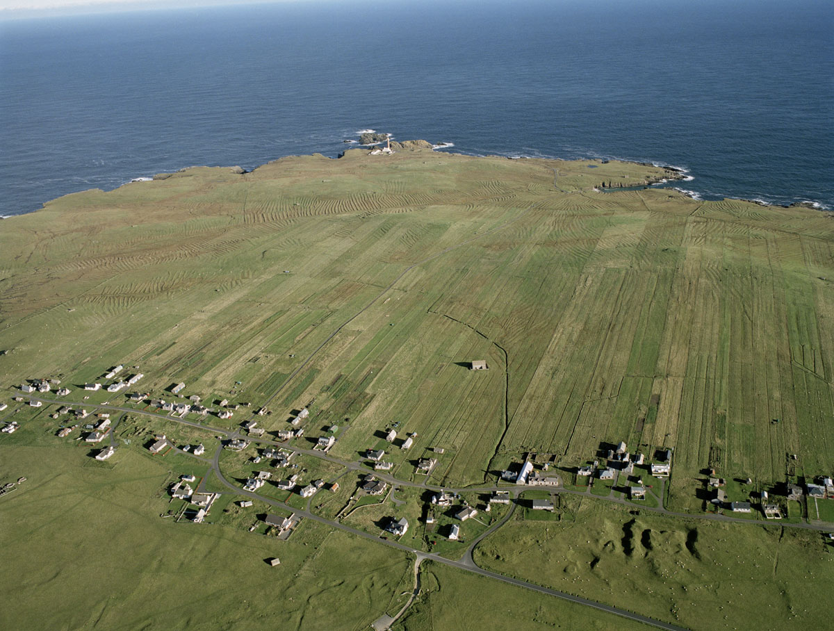
The crofting township at Eoropie on Lewis has unusually long narrow plots, other townships have broader crofts. This land use is recorded on 1st and 2nd edition OS maps so is easily identified, and the Crofting Commission holds a land register of all registered crofts.
HES SC968148

