
Over the past 30 to 40 years there has been a programme of archaeological aerial photographic work across Scotland. Some of the flights take advantage of summer drought to reveal evidence of past land use buried under the surface of ploughed fields.
Archaeological features may show as dark green lines or splodges in fields of growing crops. Alternatively, parched patches in grass pasture may indicate the presence of underlying occupation or land use. The form and period of many of these features can be identified from the photographs. They may have the same characteristics as sites that are still upstanding elsewhere, or be similar to examples that have been excavated. But there are patches and patterns that are impossible to interpret without further investigation in the future. These are noted as possible archaeological features but cannot be dated at this stage.
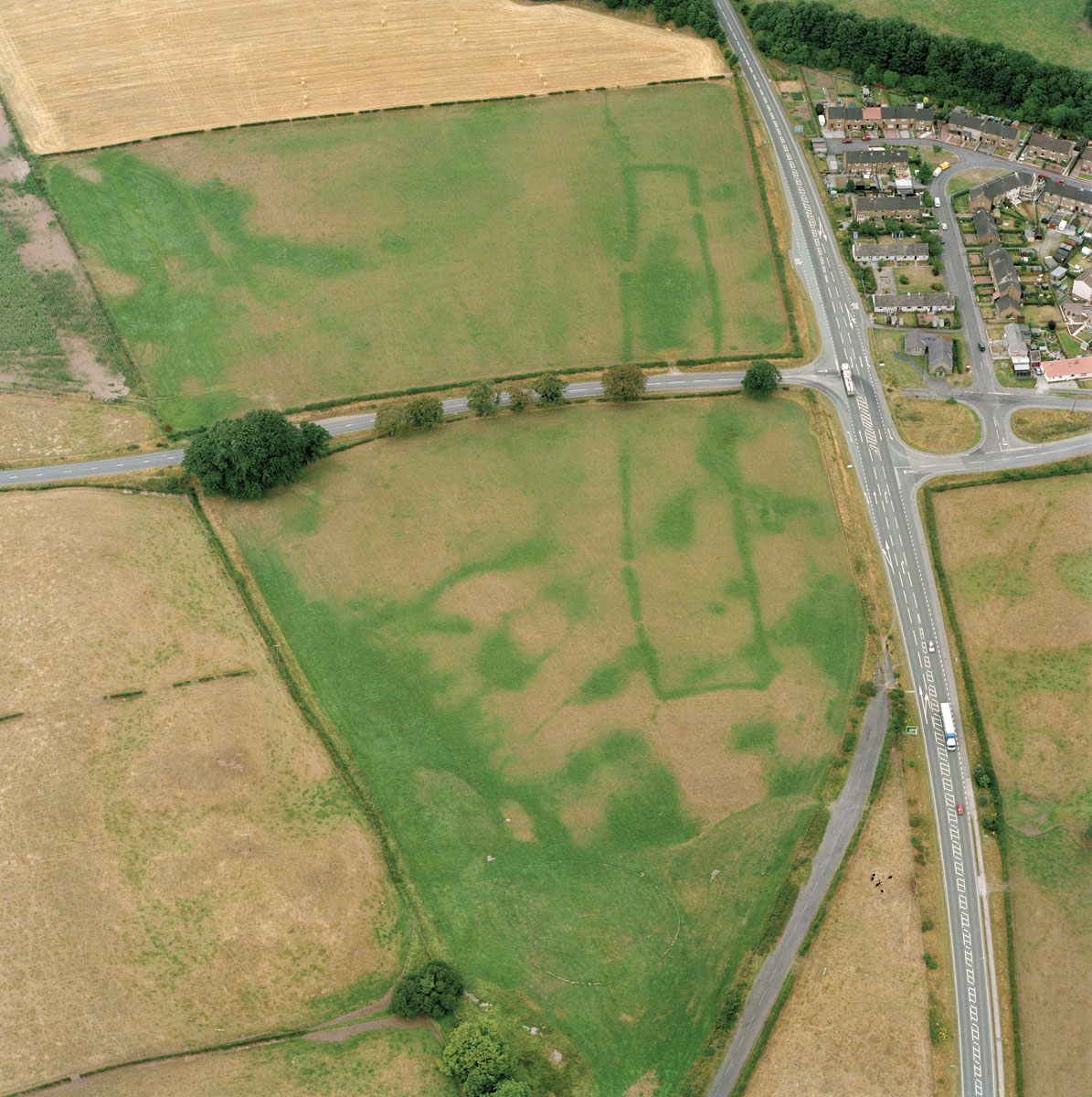
This long rectangular cropmark is not visible on the ground but from the air it can be seen in years when the fields are parched. It is all that remains of an early prehistoric ritual site – the Holywood South Cursus near Dumfries. Oblique and vertical aerial photographs held by HES and in Canmore are the main sources for identifying cropmark sites of any period.
HES SC1099876

